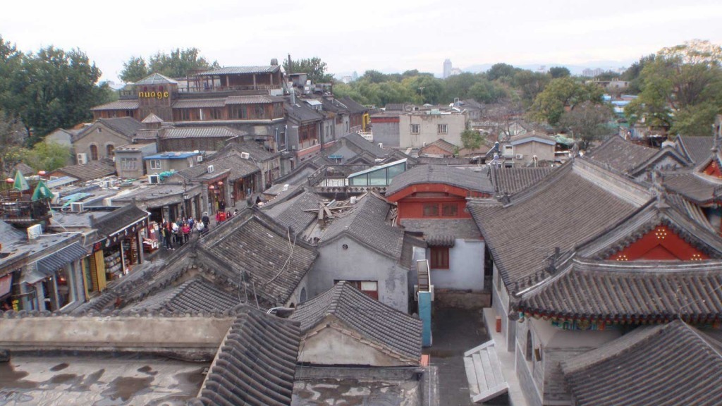
Hutongs are a type of narrow streets or alleys, commonly associated with northern Chinese cities, most prominently Beijing.
In Beijing, hutongs are alleys formed by lines of siheyuan, traditional courtyard residences.[1] Many neighbourhoods were formed by joining one siheyuan to another to form a hutong, and then joining one hutong to another. The word hutong is also used to refer to such neighbourhoods.
Since the mid-20th century, a large number of Beijing hutongs were demolished to make way for new roads and buildings. More recently, however, many hutongs have been designated as protected, in an attempt to preserve this aspect of Chinese cultural history. Hutongs were first established in the Yuan dynasty (1206–1341) and then expanded in the Ming (1368–1628) and Qing (1644–1908) dynasties.
During China’s dynastic period, emperors planned the city of Beijing and arranged the residential areas according to the social classes of the Zhou Dynasty (1027–256 BC). The term “hutong” appeared first during the Yuan Dynasty, and is a term of Mongolian origin, meaning “water well”.
In the Ming Dynasty (early 15th century), the center was the Forbidden City, surrounded in concentric circles by the Inner City and Outer City. Citizens of higher social status were permitted to live closer to the center of the circles. Aristocrats lived to the east and west of the imperial palace. The large siheyuan of these high-ranking officials and wealthy merchants often featured beautifully carved and painted roof beams and pillars and carefully landscaped gardens. The hutongs they formed were orderly, lined by spacious homes and walled gardens. Farther from the palace, and to its north and south, were the commoners, merchants, artisans, and laborers. Their siheyuan were far smaller in scale and simpler in design and decoration, and the hutongs were narrower.
Nearly all siheyuan had their main buildings and gates facing south for better lighting; thus a majority of hutongs run from east to west. Between the main hutongs, many tiny lanes ran north and south for convenient passage.
Historically, a hutong was also once used as the lowest level of administrative geographical divisions within a city in ancient China, as in the paifang system: the largest division within a city in ancient China was a fang , equivalent to current day precinct. Each fang was enclosed by walls or fences, and the gates of these enclosures were shut and guarded every night, somewhat like a modern gated community. Each fang was further divided into several plate or pai , which is equivalent to a current day (unincorporated) community (or neighborhood). Each pai , in turn, contained an area including several hutongs, and during the Ming Dynasty, Beijing was divided into a total of 36 fangs.
However, as the ancient Chinese urban administration division system gave way to population and household divisions instead of geographical divisions, the hutongs were no longer used as the lowest level of administrative geographical division and were replaced with other divisional approaches.